Image credit : Nature Conservancy , Canada.
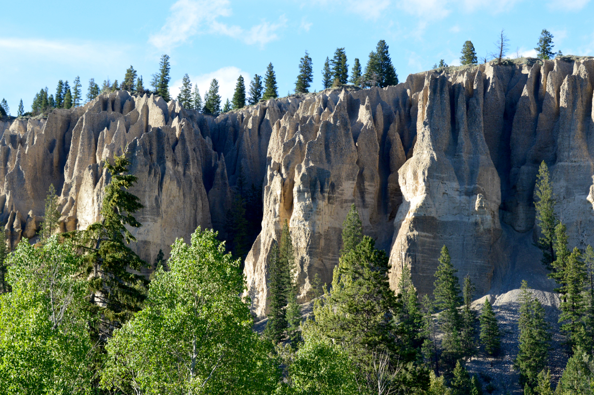
The Dutch Creek Hoodoos are located in British Columbia, Canada, and
can be seen along British Columbia Highway 93/British Columbia Highway 95 between Canal Flats and Fairmont Hot Springs, British Columbia.
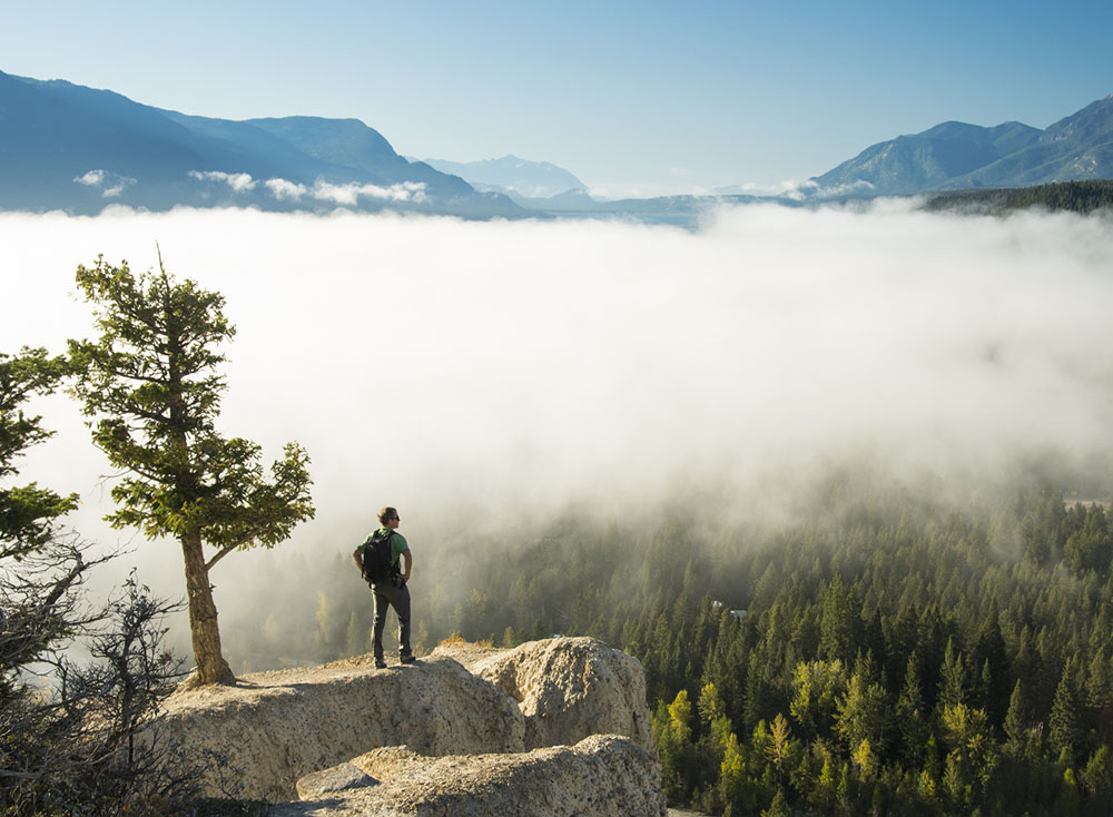
The Dutch Creek Hoodoos are within a 67-acre conservation area that is managed by the Natural Conservancy of British Columbia.
This conservation area is joined by the Nature Trust Hoffert Property and
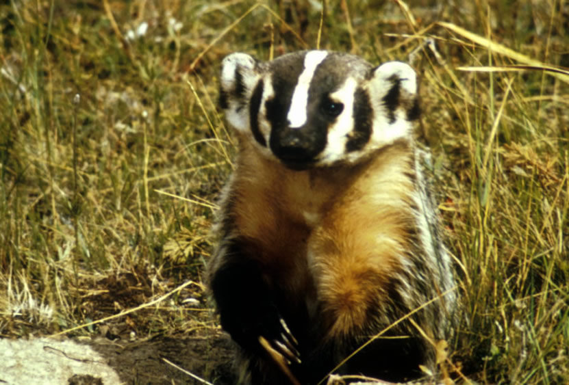
they both act as a habitat for varying plants and animals including the American badger, Lewis's woodpecker, the Hooker's Townsendia, Eagle, and Hawk.
The Dutch Creek Hoodoos can be further discovered by following the 4.6 mile trail that faces an elevation gain of 95 meters over the course of the trail.
A result of thousands of years of glaciation, followed by erosion from meltwater and weather, the Dutch Creek Hoodoos are a testament to the grand geologic forces of the area
The Dutch Creek Hoodoos Conservation Area was generously donated to NCC (Nature Conservancy Canada) in 2005 by previous owners Jim and Gaetane Ashworth in order to protect the ecologically and culturally important hoodoo formations.
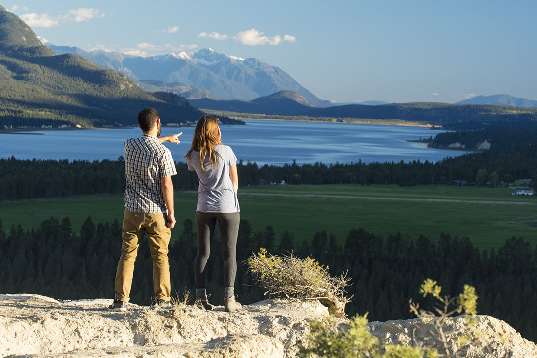
The Dutch Creek Hoodoos Conservation Area is part of a network of conservation and Crown land in the Columbia Valley. The area includes several other NCC conservation areas, such as Kootenay River Ranch, Thunder Hill Ranch, Columbia Lake-Lot 48 and Marion Creek Benchlands. Together, these areas protect vital habitat for species, including mule deer and badger.
The geologic story of the hoodoos captures the imagination of many visitors.
Millions of years ago, when the Rocky Mountains were buried under a vast blanket of ice, glaciers carved jagged peaks and deep valleys. This eroded the underlying rocks into layers of gravel, sand and salt, called "glacial till." As the glaciers began to melt 10,000 years ago, the Rocky Mountain Trench (large valley in the northern part of the Rocky Mountains) was filled with large lakes, and glacial till collected on the lake bottoms. The Dutch Creek Hoodoos were formed out of the remnants of this glacial lake bottom.
The hoodoos also provide nesting and feeding habitat for a number of birds. The cliffs offer protection from the many raptors that circle nearby fields looking for small prey. Songbirds, such as white-throated swift and violet-green swallow, find safety for their young by building their nests on the cliff face.

American Badger
Image credit : Nature Conservancy , Canada.
Formation
Millions of years ago, when the Rocky Mountains were buried under a vast blanket of ice, glaciers carved jagged peaks and deep valleys, eroding the underlying rocks into layers of gravel, sand and salt called "glacial till." As the glaciers began to melt 10,000 years ago, the Rocky Mountain Trench was filled with large lakes, and glacial till collected on the lake bottoms. The Dutch Creek Hoodoos were formed out of the remnants of this glacial lake bottom.

Image credit : Nature Conservancy , Canada.
Over time, rain, wind and frost have worn away the cliffs, creating the ridges and turrets that catch the sun and create giant, warbling shadows. To this day, the hoodoos continue to change form and shape through natural weathering.
Hoodoos tend to be found in dry landscapes and may also be referred to as fairy chimneys, tent rocks and earth pyramids. The Dutch Creek Hoodoos are an uncontested landmark in the Columbia Valley.
The Dutch Creek Hoodoos are formed just like all other Hoodoos form.
Over time as the ground shifts and moves cracks form that causes pockets to form. When rain begins to fall it is easily caught in the cracks and can often settle within those pockets. As temperatures drop the water freezes and expands the pockets often causing larger portions of rock to break off. This process is referred to as Ice Wedging and the repeating of this process causes the formation of a Fin. When ice wedging occurs within the fin a Window can form and when a window can no longer support the weight it breaks and leaves behind what we now call a Hoodoo.
History
The Ktunaxa Nation is made up of the Kootenai tribe that is made up of people from Idaho, Montana, and British Columbia Canada. Throughout history, the Ktunaxa nation has told their Creation story that depicts how the Ktunaxa nations boundaries and lakes was formed. At the roots of the Ktunaxa nation you'd find an ancestral world full of animals because humans had not yet been created. During those ancestral times the ancient sea monster Yawunik was known to kill a number of animals so a council head up by the Chief animal Nalmuqcin was formed to defeat Yawunik. The council combined the Kootenay River and Columbia River systems to trap Yawunik within the Columbia Lake and chased him throughout the river system.
Over the course of this chase Yawunik gave name to many well known locations near the rivers and lakes of Canada. As the chase continued so did the naming of locations along the way. After failing to capture Yawunik multiple times Nalmuqcin sat along the river and had a conversation with Kikum. Kikum was a wise old one who suggested that Nalmuqcin use his size and strength to block the flow of the river into the lake and successfully trap Yawunik within. When they implemented the plan, the council was able to trap Yawunik and send in Yamakpal to deliver the final blow and drag his remains ashore. The bones of Yawunik were scattered around and the ribs were what we now refer to as the Dutch Creek Hoodoos. The different colored remains were scattered around the new nation and the different colors represented the different races of people that would congregate within that area including white, black, yellow, and red.
The story comes to an end as Malnuqcin stands up overjoyed at the councils recent accomplishments and hits his head on the ceiling of the sky successfully knocking himself dead. The varying portions of his very large body are said to be strewn throughout many well known locations such as Yellowhead Pass, Yellowstone Park, and the Rocky Mountains. The Ktunaxa Nation believes the people were then deemed the keepers of the land and the many animals were able to ascend to the above and act as spirit guides to the people who remained below.

Image credit : usra.edu
Rising dramatically above a curve in the road along Canada's north-south Highway 93 and 95, British Columbia's pine-fringed and buff-colored Dutch Creek hoodoos prompt many a cross-country traveler to stop and gawk, which is precisely what happened when this photograph was taken on June 11, 2018.
The crags and pinnacles of the Dutch Creek Hoodoos Conservation Area, near Fairmont Hot Springs, testify to millions of years of glaciation and deposition, for the formations trace back to the Pleistocene when Canada's Rocky Mountains were blanketed by Ice Age glaciers. The ice carved and sliced into the region's peaks and valleys, turning the resulting sand and gravel debris into glacial till. When the glaciers began to melt over 10,000 years ago, glacial till collected on lake bottoms in the Rocky Mountain Trench explains Nature Conservancy Canada.
Although many lakes remain - including nearby Columbia Lake, at the headwaters of the mighty Columbia River - they also dwindled over time, leaving behind bluffs, benchlands and cliffs, including the strata above Dutch Creek. Over the past several thousand years, rain, meltwater and wind weathered and eroded the soft till, forming chasms and spires reminiscent of other hoodoo landscapes, such as Utah's Bryce Canyon National Park and Turkey's Cappadocia.
Photo Details: Camera: NIKON D3200; Exposure Time: 0.0040s (1/250); Aperture:
f/10.0; ISO equivalent: 400; Focal Length (35mm): 105.
Dutch Creek Hoodoos Conservation Area, B.C. Coordinates: 50.3125, -115.8957


