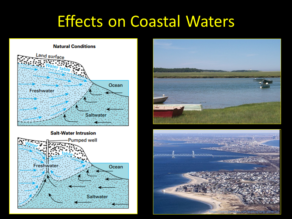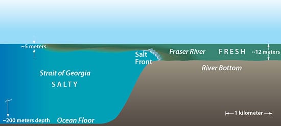


The ice in a glacier is composed of water that originally fell as snow and thus contains relatively low levels of dissolved materials. When it melts, it forms liquid freshwater that has a density very close to one gram per cubic centimeter (1.0 g/cm3). Seawater on the other hand has an average density of about 1.03 g/cm3 due to the rather large quantity of salts that are dissolved in it.
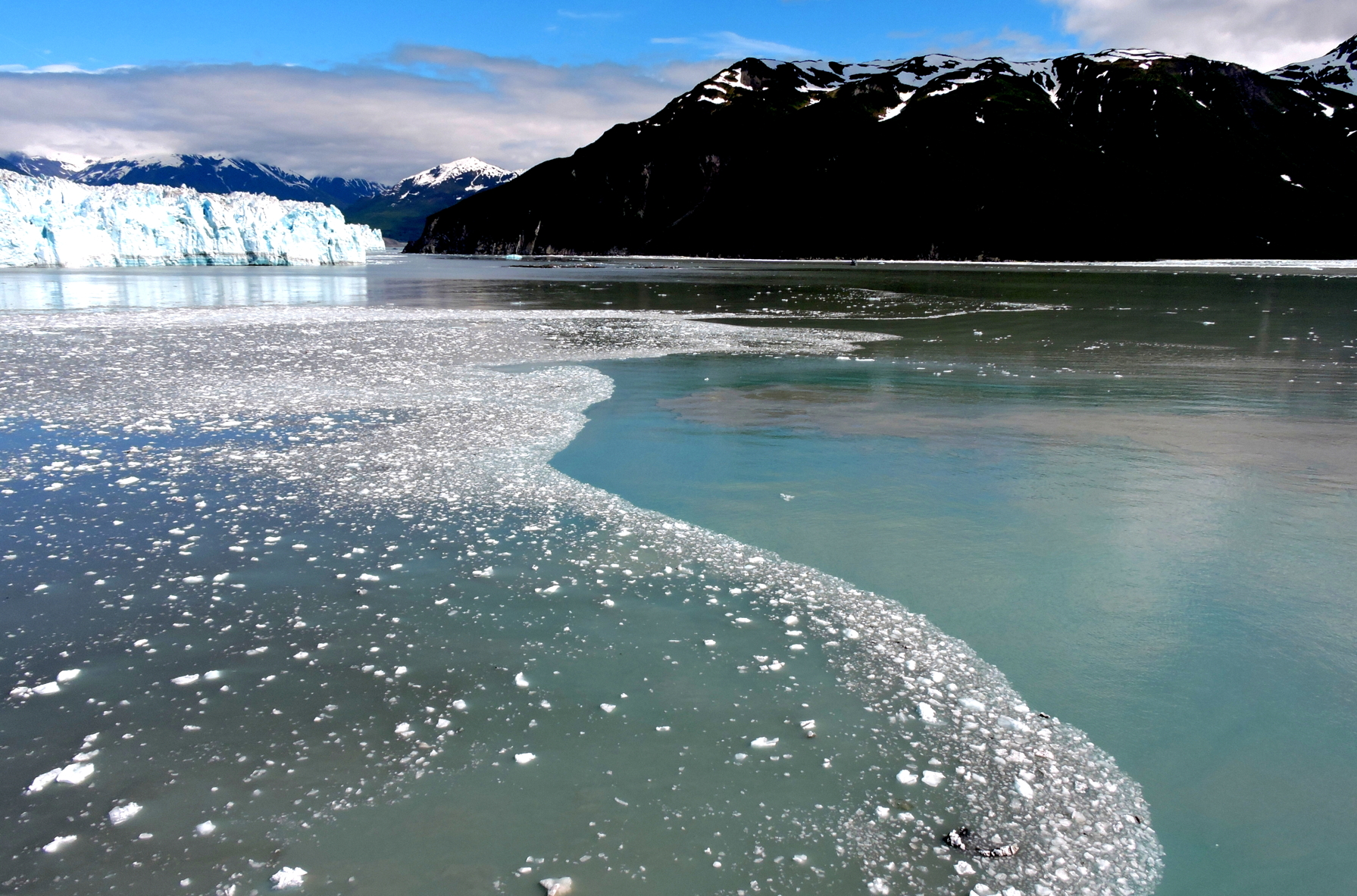
When ice is calved from the front of a tidewater glacier, it falls into seawater, floats there for a while and then eventually melts. As it melts, it forms a stable layer of freshwater that in essence floats upon the denser seawater below. If there's little wind or other disturbance to upset this stability, the layering may persist for quite a period of time until random diffusion eventually breaks it up. In the above photograph, small bits of ice from southeast Alaska's Hubbard Glacier remain entrapped in the layer of freshwater that forms a visible boundary with the denser seawater. Photo taken on June 19, 2019.
Hubbard Glacier, Alaska Coordinates: 60.027738, -139.546720
Hubbard Glacier is the largest tidewater glacier on the North American continent. It has been thickening and advancing toward the Gulf of Alaska since it was first mapped by the International Boundary Commission in 1895 (Davidson, 1903). This is in stark contrast with most glaciers, which have thinned and retreated during the last century. This atypical behavior is an important example of the calving glacier cycle in which glacier advance and retreat is controlled more by the mechanics of terminus calving than by climate fluctuations. If Hubbard Glacier continues to advance, it will close the seaward entrance of Russell Fiord and create the largest glacier-dammed lake on the North American continent in historic times as it has done in 1986 and 2002. The Slow Advance of a Calving Glacier: Hubbard Glacier, AK is a summary of growth and advance measurements of Hubbard Glacier as presented at the International Glaciological Society symposium on Fast Glacier Flow held in Yakutat, Alaska, June 10-14, 2002. Hubbard Glacier remains an ongoing study of calving glacier dynamics for the scientific community
Hubbard Glacier creates dam on Russell Fiord
In 2002 the advancing terminus of Hubbard Glacier created a glacier lake dam which turned Russell Fiord in to a lake for about two and a half months. Rising water in the newly formed lake altered local hydrology and was a threat to nearby communities. During the two and a half months that the channel was dammed, Russell Lake rose 61 feet. In 1986 a similar scenario resulted when the glacier caused dam raised the lake level 84 feet over the course of five months. Erosion from water eventually carved a new outlet channel and restored the fiord to its previous elevation in both cases. In 2002 the rising level of Russell Lake was recorded by a stage recorder installed on June 23, 2002 at Marble Point in Russell Lake (about 4.5 miles south east from the near-closure site). Output from USGS station #15130000 shows the 2002 lake rise and outburst. Photos of Hubbard Glacier advancing show the advancement of the glacier and eventual closure of the seaward entrance to Russell Fiord.


