Image Credit : pixabay (free license)
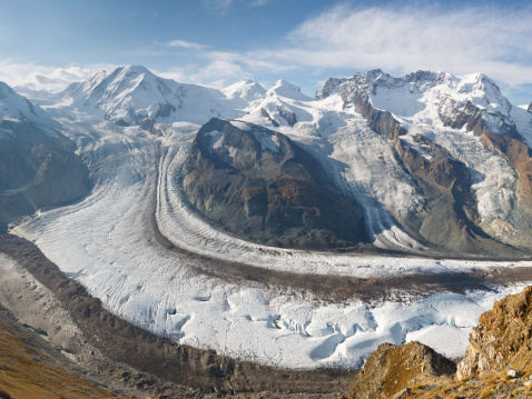
The Gorner Glacier (German: Gornergletscher) is a valley glacier found on the west side of the Monte Rosa massif close to Zermatt in the canton of Valais, Switzerland. It is about 12.4 km (7.7 mi) long (2014) and 1 to 1.5 km (0.62 to 0.93 mi) wide. The entire glacial year of the glacier related to Gorner Glacier is 83 km2 (32 sq mi) (1999), which makes it the second largest glacial system in the Alps after the Aletsch Glacier system; however it ranks only third in length behind the Aletsch and Fiescher Glacier, respectively. Numerous smaller glaciers connect with the Gorner Glacier. Its (former) tributaries are (clockwise on this map): Gornergletscher (after which the whole system is named, but the upper part is now disconnected from the lower part), Monte Rosa Gletscher, Grenzgletscher (nowadays by far its main tributary, now disconnected from the actual Gornergletscher), Zwillingsgletscher, Schwarzegletscher, Breithorngletscher, Triftjigletscher, and Unterer Theodulgletscher (although the last three ones are actually disconnected now).
The Grenzgletscher (English: Border Glacier) between the central Monte Rosa massif and the Liskamm to the south is nowadays by far the lower Gorner Glacier's main tributary. The Gorner Glacier's upper part is almost already disconnected from its lower part. Also the former tributaries Breithorngletscher, Triftjigletscher, and Unterer Theodulgletscher lost their connections to the Gorner Glacier during the last century; the Lower Theodul Glacier became disconnected in the 1980s.
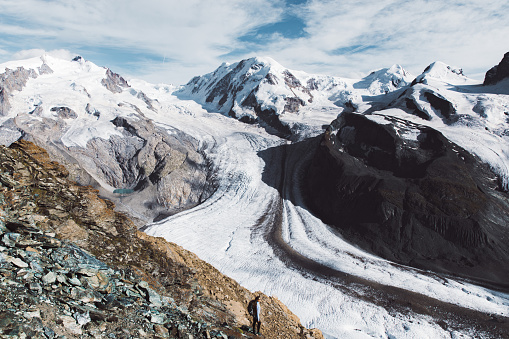
Image Credit : unsplash (free license)
Like almost all other glaciers in the Alps, and most glaciers on the globe as well, due to global warming the Gorner Glacier is a retreating glacier-and in quite a dramatic way. Nowadays (2014), Gorner Glacier retreats about 30 metres (98 ft) every year, but with a record loss of 290 metres (950 ft) in 2008. Since its last major expansion (in the modern era, after the last glacial period) in 1859, it lost more than 2,500 metres (8,200 ft) in distance.
In these days (c. 2015) this becomes quite obvious because the uneducated visitor usually misidentifies Gorner Glacier's main tributary as its upper part: the Grenzgletscher (English: Border Glacier) on the south side of the central, visible Monte Rosa massif. However, the upper Gorner Glacier traditionally is to be found on the north side. The reason is that the upper part of the Gorner Glacier is currently losing contact with its lower part and now the Grenzgletscher has become its much larger tributary. So it is easy to mismatch the Border Glacier as the upper Gorner Glacier.
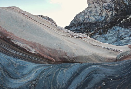
Image Credit : unsplash (free license)
An interesting feature of this glacier is the Gornersee, an ice marginal lake at the confluence area of the Gorner- and Grenzgletscher. This lake fills every year and drains in summer, usually as a Glacial lake outburst flood. This is one of few glacial lakes in the Alps exhibiting this kind of behaviour.
There are pie also several interesting surface features including crevasses and "table top" forms where large surface boulders have been left stranded above the glaciers surface. These tabular rocks are supported by ice that the boulder has sheltered from melting that has effected the more exposed surrounding ice.
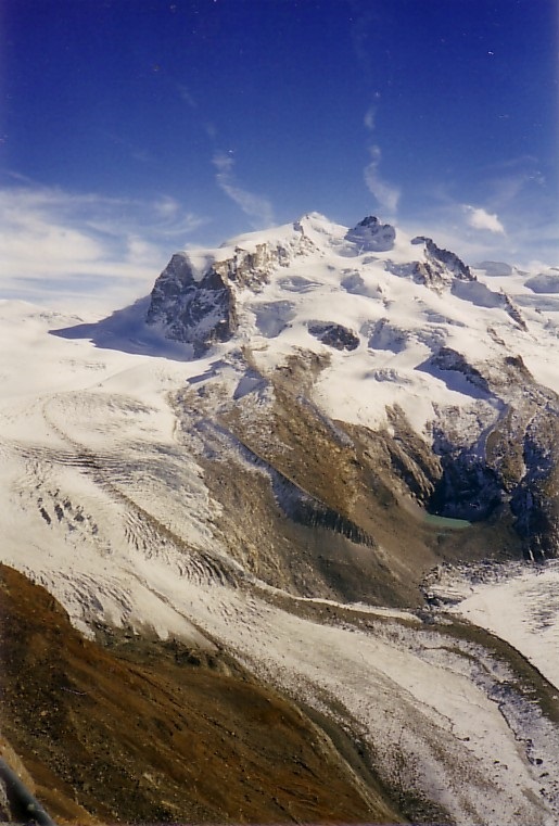
Image Credit : Wikimedia Commons (free license)
|
Due to the immense information about the glacier, it is perfect for a glacier project.
It is the source of the river Gornera, which flows down through Zermatt itself. However, most of its water is captured by a water catchment station of the Grande Dixence hydroelectric power plant. This water then ends up in the Lac des Dix, the main reservoir of Grande Dixence.
The glacier as well as the surrounding mountains can be seen from the Gornergrat (3,100 m or 10,200 ft), connected from Zermatt by the Gornergrat Railway.
This hike leads to the dramatic rugged terrain of the lower Gorner glacier. During the last 150 years, it has retreated by over 3,000 m. Anyone interested in climate change can witness the process of a major glacier melting every step of the way.
The hike begins in a leisurely way. You walk over green mountain meadows and pass through sparse larch and Alpine pine forests. After the "Im Boden" area, you leave the hanging bridge on the left and arrive at the intersection of the two streams, the Furggbach and the Gornera; the latter is the outflow from the Gorner glacier. You cross the streams on small bridges, under which the streams murmur or change to thunderous grey behemoths depending on the time of year, weather, and the melt-off from the glacier. Then the path continues upwards along the left side of the Gornera. The landscape here is no longer "charming"; this is "pathfinder territory" where debris fields pile up the rubble while pioneer larch trees have already put down roots. In the valley below is the steep climb to the vantage point at Blattenten.
Glaciers grow and shrink - over the centuries and the millennia. The Gorner glacier reached its maximum length between 1859 and 1865, then also in 1667, and in 1385. In between those milestones, the glacier retreated by about 1,000 m. There was hardly any glacial mass that could be called the Gorner glacier - in other words, it did not exist in the year 1,000 and during the century when Christ was born. The information boards along the signed theme way explain the phenomenon of glacier existence.
On the return path, the Dossen glacier garden can also be visited.
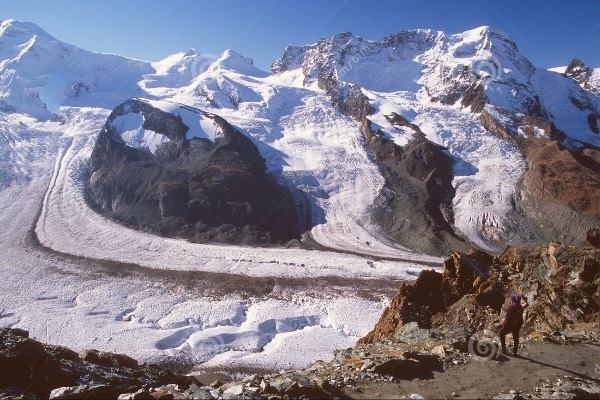
Image Credit : pixabay (free license)
There are ten boards along the path in German and English explaining the glacier world. The history of the "Im Boden" alp, which was buried under the advancing ice mass in the 19th century, is exciting. As is also the fact that the local people undertook a tree-clearing process to steal the valuable wood away from the greedy gullet of the advancing glacier.
A trip to the Gornergrat is a 'must' for visitors to Zermatt. The ride by train up to the Gornergrat takes around 35 minutes and when you get to the top you have an amazing, 360
o panoramic view in the midst of the Alps: the Matterhorn, Liskamm and the Monte-Rosa group plus a vista of the glaciers.
On the route to the Monte-Rosa hut walkers must cross the Gorner glacier. It is advised to have a mountain guide when you take this route. A seldom frequented hiking trail leads from the Hohtalli ridge almost down to the glacier. From here, the hike continues through some of the most beautiful scenery towards the Riffelsee lake.
The glacier area on the Gornergrat
In addition to the merging of the Gorner Glacier and the Grenz Glacier,
there are numerous other glaciers to be seen from the Gornergrat. Around 7 larger and smaller glaciers are visible from the Gornergrat.
Take a few minutes on the Gornergrat to enjoy the view of all the surrounding glaciers which are listed below.
Gornergletscher
Grenzgletscher
Zwillinggletscher
Schwarzgletscher
Breithorngletscher
Unterer Theodulgletscher
Oberer Theodulgletscher


