Image credit: Pixabay (free license)
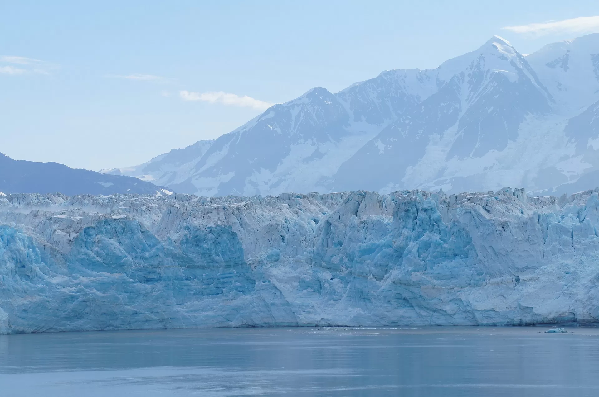
Hubbard Glacier is a glacier located in Wrangell-St. Elias National Park and Preserve in eastern Alaska and Kluane National Park and Reserve in Yukon, Canada, and named after Gardiner Hubbard.
Hubbard Glacier, Alaska, squeezed towards Gilbert Point on May 20, 2002. The glacier is close to sealing off Russell Fjord at top from Disenchantment Bay at bottom.
The longest source for Hubbard Glacier originates 122 kilometres (76 mi) from its snout and is located at about 61°00'N 140°09'W, approximately 8 kilometres (5 mi) west of Mount Walsh with an elevation around 11,000 feet (3,400 m). A shorter tributary glacier begins at the easternmost summit on the Mount Logan ridge at about 18,300 feet (5,600 m) at about 60°35'0"N 140°22'40"W.
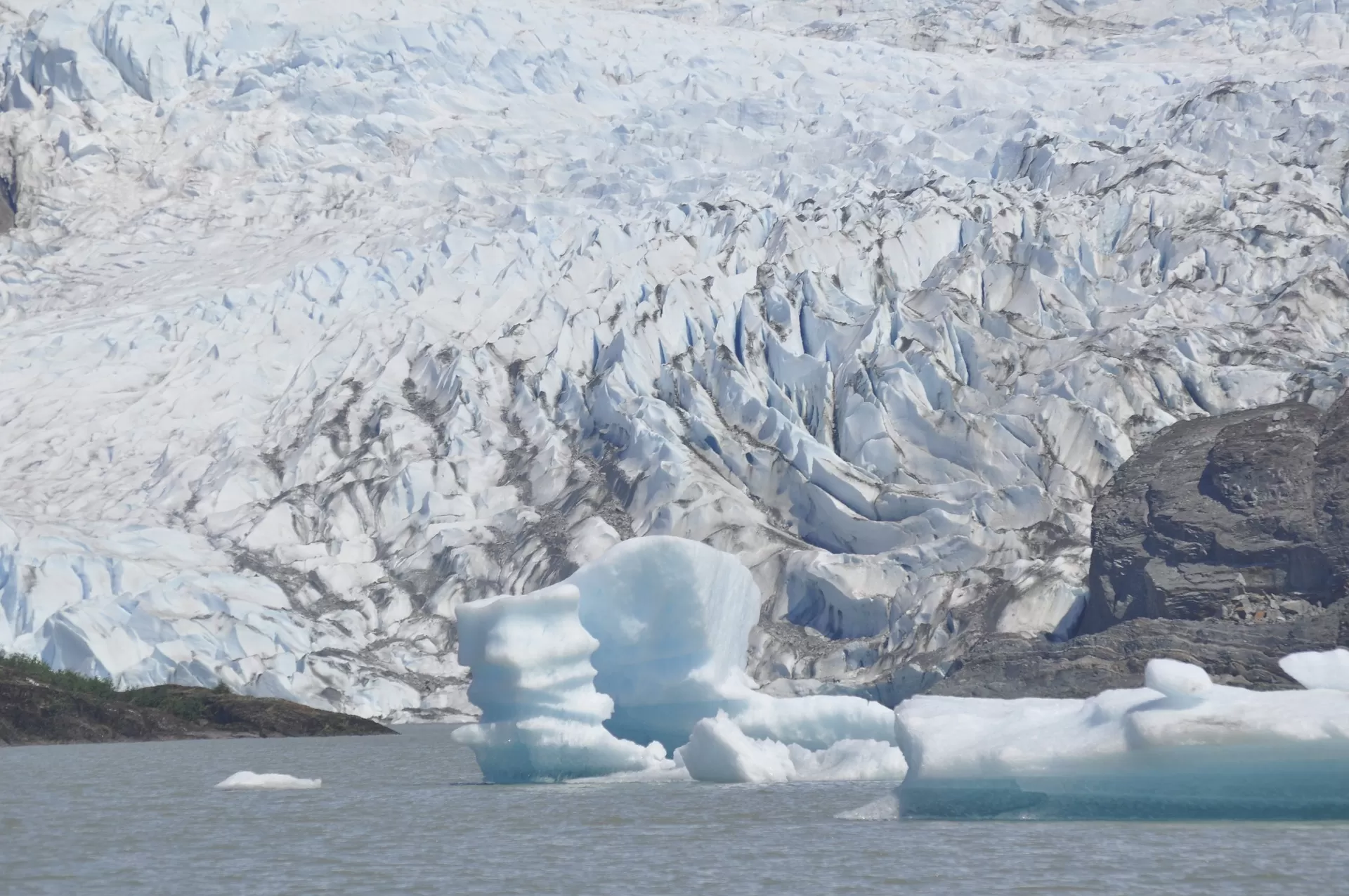
Image credit: Pixabay (free license)
Before it reaches the sea, Hubbard is joined by the Valerie Glacier to the west, which, through forward surges of its own ice, has contributed to the advance of the ice flow that experts believe will eventually dam the Russell Fjord from Disenchantment Bay waters.
The Hubbard Glacier ice margin has continued to advance for about a century. In May 1986, the Hubbard Glacier surged forward, blocking the outlet of Russell Fjord and creating Russell Lake. All that summer, the new lake filled with runoff; its water level rose 25 metres (82 ft), and the decrease in salinity threatened its sea life.
Around midnight on October 8, the dam began to give way. In the next 24 hours, an estimated 5.3 cubic kilometres (1.3 cu mi) of water gushed through the gap, and the fjord was reconnected to the ocean at its previous level. This was the largest glacial lake outburst flood (GLOF) in recorded history.
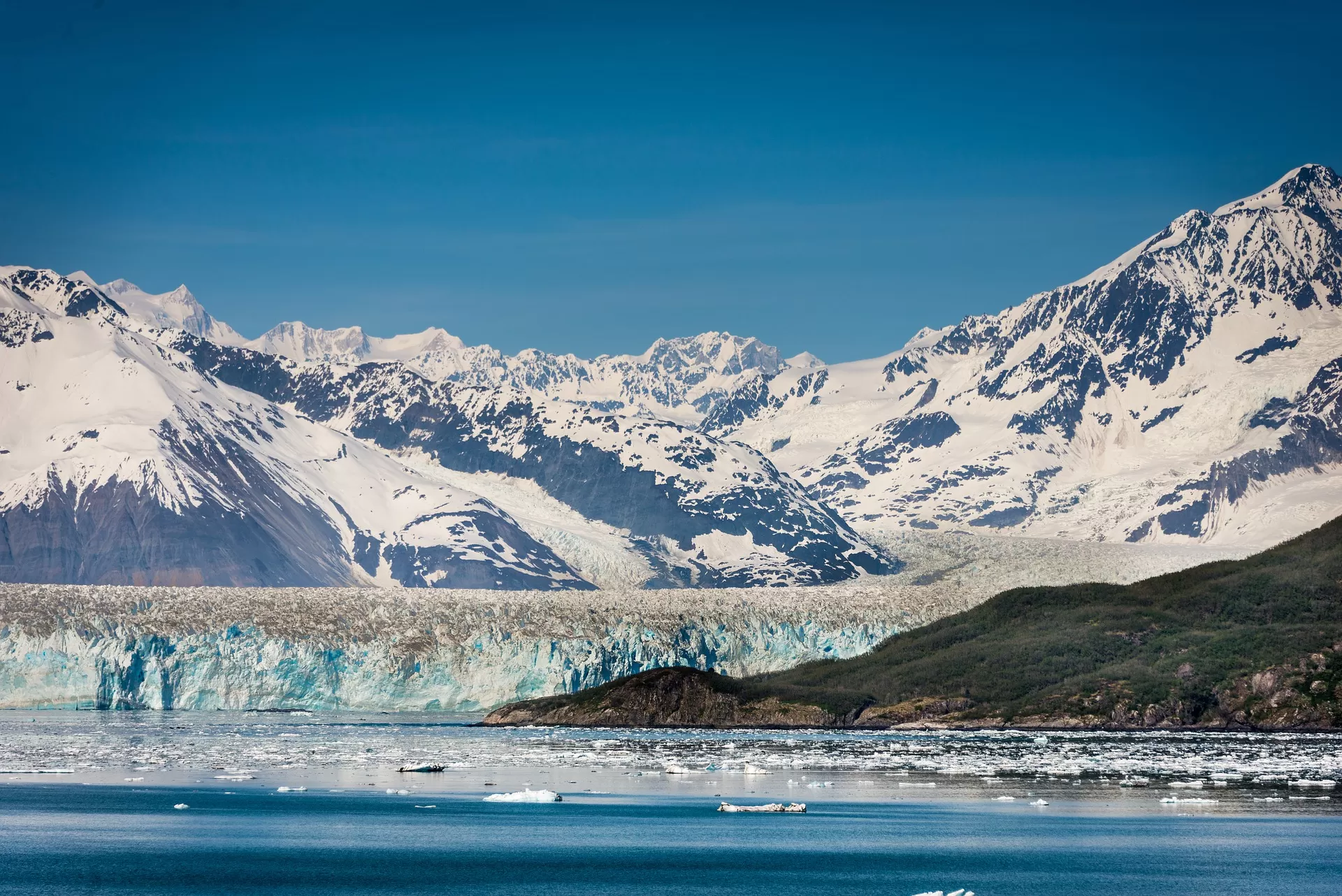
Image credit: Pixabay (free license)
In spring 2002, the glacier again approached Bert Point. It pushed a terminal moraine ahead of its face and closed the opening again in July. On August 14, the terminal moraine was washed away after rains had raised the water level behind the dam it formed to 18 m (59 ft) above sea level. The fjord could become dammed again, and perhaps permanently. If this happens, the fjord could overflow its southern banks and drain through the Situk River instead, threatening trout habitat and a local airport.
It takes about 400 years for ice to traverse the length of the glacier, meaning that the ice at the foot of the glacier is about 400 years old. The glacier routinely calvesoff icebergs the size of a ten-story building. Where the glacier meets the bay, most of the ice is below the waterline, and newly calved icebergs can shoot up quite dramatically, so that ships must keep their distance from the edge of the glacier in Disenchantment Bay.
Hubbard Glacier is the largest tidewater glacier on the North American continent. It has been thickening and advancing toward the Gulf of Alaska since it was first mapped by the International Boundary Commission in 1895 (Davidson, 1903). This is in stark contrast with most glaciers, which have thinned and retreated during the last century. This atypical behavior is an important example of the calving glacier cycle in which glacier advance and retreat is controlled more by the mechanics of terminus calving than by climate fluctuations.
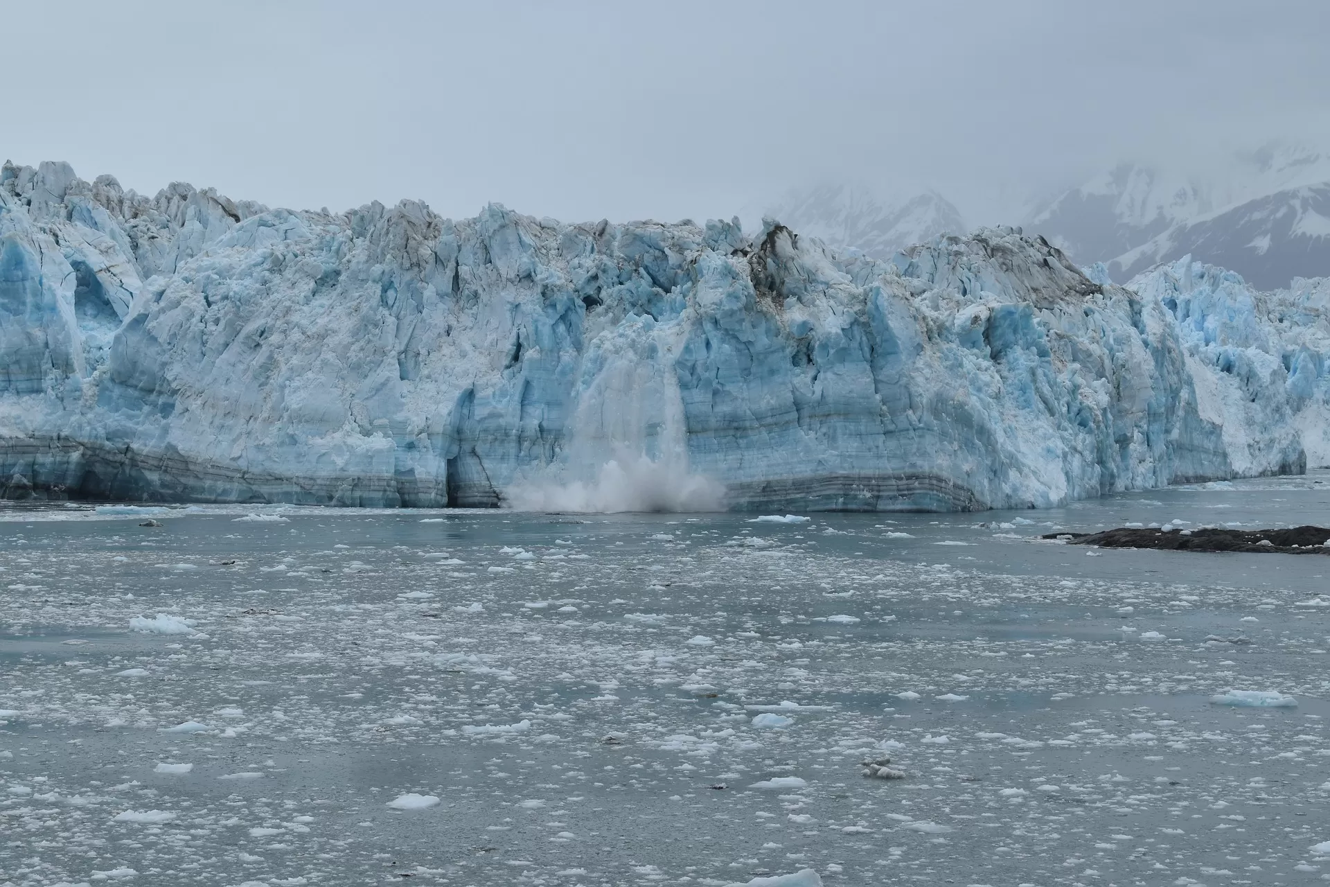
Image credit: Pixabay (free license)
If Hubbard Glacier continues to advance, it will close the seaward entrance of Russell Fiord and create the largest glacier-dammed lake on the North American continent in historic times as it has done in 1986 and 2002. The Slow Advance of a Calving Glacier: Hubbard Glacier, AK is a summary of growth and advance measurements of Hubbard Glacier as presented at the International Glaciological Society symposium on Fast Glacier Flow held in Yakutat, Alaska, June 10-14, 2002. Hubbard Glacier remains an ongoing study of calving glacier dynamics for the scientific community
Hubbard Glacier creates dam on Russell Fiord
In 2002 the advancing terminus of Hubbard Glacier created a glacier lake dam which turned Russell Fiord in to a lake for about two and a half months. Rising water in the newly formed lake altered local hydrology and was a threat to nearby communities. During the two and a half months that the channel was dammed, Russell Lake rose 61 feet. In 1986 a similar scenario resulted when the glacier caused dam raised the lake level 84 feet over the course of five months.
Erosion from water eventually carved a new outlet channel and restored the fiord to its previous elevation in both cases. In 2002 the rising level of Russell Lake was recorded by a stage recorder installed on June 23, 2002 at Marble Point in Russell Lake (about 4.5 miles south east from the near-closure site). Output from USGS station #15130000 shows the 2002 lake rise and outburst. Photos of Hubbard Glacier advancing show the advancement of the glacier and eventual closure of the seaward entrance to Russell Fiord.
Hubbard Glacier, Alaska: Growing and Advancing in Spite of Global - Climate Change and the 1986 and 2002 Russell Lake Outburst Floods
Hubbard Glacier, the largest calving glacier
on the North American Continent (25 percent
larger than Rhode Island), advanced across the
entrance to 35-mile-long Russell Fiord
during June 2002, temporarily turning it into
a lake. Hubbard Glacier has been advancing
for more than 100 years and has twice closed
the entrance to Russell Fiord during the last
16 years by squeezing and pushing submarine
glacial sediments across the mouth of the fi ord.
Water flowing into the cut-off
fi ord from mountain streams and glacier melt
causes the level of Russell Lake to rise. However both the 1986 and 2002 dams failed
before the lake altitude rose enough for water to
spill over a low pass at the far end of the fi ord
and enter the Situk River drainage, a worldclass sport and commercial fi shery near Yakutat,
Alaska.

Image credit: Pixabay (free license)
Calving Glaciers are Unresponsiveto Climate:
Hubbard Glacier is defying the global paradigm of valley or mountain glacier shrinkage
and retreat in response to global climate warming. Hubbard Glacier is the largest of eight
calving glaciers in Alaska that are currently
increasing in total mass and advancing.
All of these glaciers calve into the sea, are at the
heads of long fi ords, have undergone retreats
during the last 1,000 years, calve over relatively
shallow submarine moraines, and have unusually small ablation areas compared to their
accumulation areas
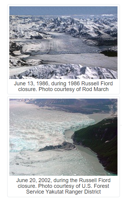
Image credit: National snow & ice data center
|
For example, Hubbard Glacier retreated about 38 miles
between 1130 A.D. and late in the 19th century.
The fi ord bottom lies 1,300 feet below sea level under
the glacier, shallows to a depth of 200-250 feet at the
glacier calving terminus, and then deepens again to as
much as 750 feet below sea level down Disenchantment Bay. The accumulation area of Hubbard Glacier is
95 percent of the entire glacier area and, like the other
growing calving glaciers, is far from being in equilibrium with climate.
The large calving glaciers that are currently advancing have been discordant with climate-driven glacier
changes for a very long time. The glaciers that are
currently growing and advancing in the face of global
warming were retreating throughout the Little Ice Age
(AD1350 or 1450 to AD1900) when most glaciers were growing.
|
The 1986 and 2002 Formation and Growth of
Russell Lake
The 1986 closure occurred near the fi rst of June; the 2002
closure was gradual and was complete about June 16. The
newly closed Russell Lake basin fi lled at the average rate
of 0.7 feet per day in both 1986 and 2002 (fi g. 5). No water
was visibly leaking through or over the dam during the 1986
closure. However, relatively small amounts of lake water
overfl owed the 2002 moraine dam during most of the period
of closure . This observation suggests that the damming moraine was being squeezed higher above sea level.
Long-Term Advance and Repeat Closure of Russell Fiord Expected:
Hubbard Glacier has advanced at a rate of about 80 feet
per year since 1895 . Although the timing is uncertain, the prospect of the glacier continuing to advance and
again blocking the entrance to Russell Fiord is much more certain.


