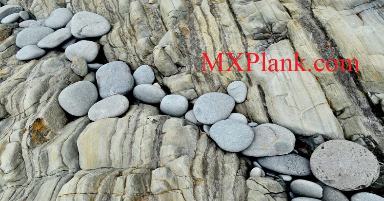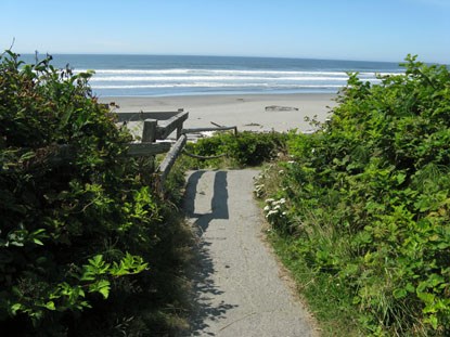

A forested trail along a Pacific Ocean-side strip of Olympic National Park leads down to Beach 4, one of a sequence of access points and beaches in the Kalaloch area from U.S. Highway 101, on the state of Washington's Olympic Peninsula. At the trail's end is a somewhat precarious scramble over the tilted and eroded sedimentary strata of what's called the Hoh rock assemblage (named for the nearby Hoh River and the Native American Hoh Tribe), sprinkled with disc-shaped stones. As illustrated in the photograph above, taken looking down upon the melange, on August. 9, 2019, the hefty tumbled and rounded rocks appear to have been arrayed upon the underlying, and upended, sedimentary outcrop over time by the ocean's tides and surf.
The coastal bluff here is composed of sand and gravel transported west from the Olympic Mountains by glaciers and streams during and at the end of the ice-age Pleistocene Epoch. The bluff also includes later marshy, fine-grained silt sediments and carbonaceous clay, which began accumulating some 70,000 years ago, and continue to do so to the present day. The beach's wave-washed Hoh assemblage sedimentary rocks, which formed 5 to 22 million years ago in a deep ocean basin to the west, have been overturned by younger strata. They're mostly thin-bedded sandstones, siltstones and conglomerates, mixed with fragments of other rocks and minerals. Geologists call these graywackes, ocean turbidites formed in conditions such as submarine avalanches or strong turbidity currents.
North of the Quinault Indian Reservation, Beach 4 - shown more extensively in a second photo taken on the same day - is popular at low tide for observing tidal pools, found along a series of small, rocky sea stacks. Anemones and starfish thrive in these pools. Visible about 3.5 miles (5.6 km) offshore is Destruction Island, once known as Green Island by early explorers, the largest island off Washington's Pacific Coast.
For thousands of marine species, these coastal waters are a safe haven. The marine environment and offshore islands are protected by three national wildlife refuges and Olympic Coast National Marine Sanctuary. The refuges manage the islands visible above high tide waters for 135 miles along the coast. Large nesting colonies of birds like common murres and tufted puffins need these rocky outposts.
Kalaloch is one of the most visited areas of Olympic National Park. Kalaloch and Ruby Beach are located on the southwest coast of the Olympic Peninsula. They are accessible directly off of Highway 101 in US.
Hiking the southern coast of the Olympic Peninsula provides some amazing sights of the pristine beaches and marine wildlife. North of Ruby Beach, the Hoh River creates a natural boundary.

Kalaloch is a great place for bird watching. Western gulls, bald eagles, and other coastal birds can be spotted nesting and feeding along the southern coast. Beach 4 is an excellent location to tidepool looking for seastars, and anemones of various colors can be seen at low tiedes. When hiking the coast, always check the tides (current charts available at the Kalaloch Information Station). Certain areas may become impassable during high tides and overland trails must be used.
Campgrounds at Kalaloch and South Beach are the only places to camp on the southern coast of Olympic National Park. Kalaloch is open year-round, and has 175 campsites, four of which are wheelchair accessible. Make sure to reserve a site as early on in the year as possible, as they fill up quickly and most are booked throughout the summer. South Beach, just south of Kalaloch, has about 50 campsites and is open Memorial Day - late September.Kalaloch Lodge, located right on the beach, has rooms and cabins available upon reservation. You can see the view from the Kalaloch Lodge by viewing their webcam!


